
Formaoil [Fermoyle Hill]
Good walks are even better shared.
Overview
Fermaoil [Fermoyle Hill]
Location: Fermoyle Hill is nestled in the stunning Kerry Mountains, not too far from the Atlantic coast. Towering at 602 meters, this Marilyn offers not only a challenge but also breathtaking views for those who dare to summit.
Geological Features
Fermoyle Hill is marked by its granite and schist composition, contributing to not just the views but also the fascinating geological features that can be explored.
Routes
The most popular route is the Fermoyle Hill Loop, starting from the lovely village of Ballinskelligs. This moderate loop is about 9 km long and typically takes about 3.5 hours to complete. Get ready to trek through a patchwork of rocky outcrops and grassy slopes while keeping an eye out for the occasional sheep—who always seem to have a better idea of the terrain than we do!
Summit Joys
The summit sports a delightful cairn and trig point, both perfect for those Instagram shots. And don’t forget to bring a snack to enjoy while gazing at the magnificent views of the Skellig Islands and the Dingle Peninsula!
Terrain and Hazards
Be prepared for rocky paths and the occasional bog patch. A sturdy pair of boots is a must, as the terrain can be uneven. Keep an eye on the weather as well—it can change faster than you can say 'Where did I last see my map?'
Access and Amenities
To make the most of your trip, park your vehicle in Ballinskelligs, where ample parking is available. Public transport options also exist, with daily bus services for those coming from nearby towns. Once you've conquered the heights, treat yourself to a well-earned bite at a local café!
Cultural Significance
Locally, Fermoyle Hill is rich in folklore and is a beloved icon among the residents. The name reflects its character, evoking images of the rugged and beautiful landscapes that define this part of Ireland.
So, lace up those boots, grab your walking stick, and prepare for an adventure that combines nature, history, and perhaps spotting a wandering sheep or two. Happy hiking!
Explore routes near Formaoil [Fermoyle Hill]
Public walks starting within 80 km of this hill. Nearby does not mean a route reaches the summit; check its map and access before setting out.
No public routes are currently listed within 80 km of Formaoil [Fermoyle Hill] on Walkmates. This does not mean there are no paths here. Explore the map and check local access information before planning a walk.
Route planning notes
These notes describe possible approaches, not verified navigable routes or permission to cross land. Check current paths, local access rules and conditions before setting out.
Fermoyle Hill Loop
A scenic loop starting from the village of Ballinskelligs, this route offers fantastic views of the surrounding mountains and coastline.
Make a day of it, together
Find someone to share the walk with, or organise a day out along a route you like.
Hill facts and local notes
Classifications
Elevation
206m
676 ft
Prominence
110m
Coordinates
51.8736, -10.2615
V443714
OS Map
83
At the Summit
The summit features a prominent cairn and a wonderful trig point that makes for a perfect photo op if you can manage to catch your breath.
Terrain & Geology
Fermoyle Hill is predominantly composed of granite and schist, giving it a rugged appearance that is typical of the Irish uplands. The erosion of these rocks has created striking glacial valleys and boulder-strewn slopes.
Views & Scenery
On a clear day, enjoy sweeping views of the Skelligs, Dingle Peninsula, and the vast Atlantic Ocean.
History & Heritage
Name Origin
The name 'Fermoyle' comes from the Irish term ‘Ferna Maolmha’, meaning ‘the place of the barren land’, which perfectly captures its rugged charm.
Historical Significance
Fermoyle Hill holds cultural significance for local communities, often being referred to in folklore and narratives that celebrate the natural beauty of the region.
Getting There & Facilities
Check current local access restrictions, parking rules and transport timetables before travelling. These notes do not confirm public access to the summit.
Parking
Parking is available at the trailhead in Ballinskelligs, with spaces for approximately 15-20 vehicles.
Public Transport
Bus services from Killarney and Cahersiveen run daily, providing an excellent way to reach Ballinskelligs.
Nearby Facilities
The village of Ballinskelligs offers a few amenities, including a quaint café and public toilets, providing a perfect pit-stop before or after your hike.
Safety Information
Known Hazards
- Steep drops near the summit, the potential for sudden weather changes, and boggy conditions in wet seasons.
General Safety Tips
- Check weather conditions before setting out
- Carry appropriate clothing and equipment
- Let someone know your planned route
- Take a map, compass, and GPS device
- Carry emergency supplies: food, water, first aid kit, torch
Hills
Some common questions about the hills answered
Are there group walks up Formaoil [Fermoyle Hill]?
Many walkers use Walkmates to join or organise walks with others. You can check for group walks around Formaoil [Fermoyle Hill] through the maps
Are there other walkers around Formaoil [Fermoyle Hill]?
Activity varies by location and time, but Walkmates lets you see whether others have shared walks or shown interest in this area. Find other people through the walking friends search walking friends for Formaoil [Fermoyle Hill] search or of course create your own walk for Formaoil [Fermoyle Hill]
Can I organise a walk to Formaoil [Fermoyle Hill]?
Yes. If there aren’t any walks listed already, you can create a walk and make it available for others to join.
If you're signed up to Walkmates, you can create a walk to Formaoil [Fermoyle Hill].
How do I find a walk up this hill?
There are often multiple ways to walk this hill, depending on experience and route preference. Walkmates helps you explore walks and routes that others have shared.
Can I suggest a new route up Formaoil [Fermoyle Hill]?
Yes. You can suggest or create routes to share with others. Walkmates focuses on the social side of walking, so routes are used to help people organise walks and explore areas together, rather than as detailed navigation tools or route libraries.
Other uses really appreciate knowledgeable walkers sharing their routes. Share your favourite route to Formaoil [Fermoyle Hill] here
The is an error or something incorrect about this hill. How do I let you know?
We always strive to keep the information on Walkmates as accurate as possible. If you find an error, please let us know through the contact form and we'll aim to correct it as quickly as possible
Community Discussion
Comments
Location
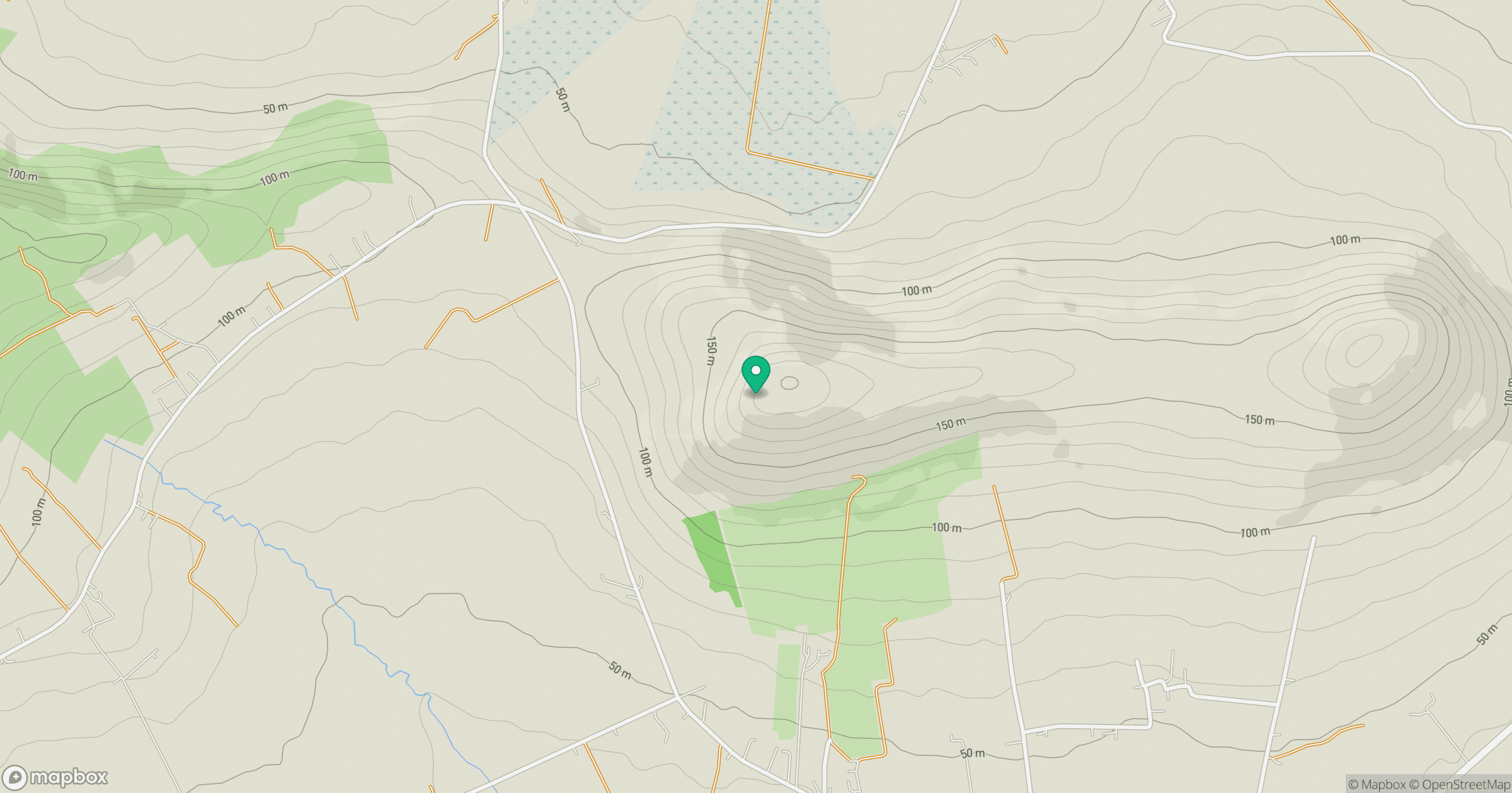
Grid reference: V443714
View on OpenStreetMapOpens a map in a new tab, centred on the hill.
Hills within 30 km
Straight-line distance, not a walking route or confirmation of access.
Sceilg Mhichil [Great Skellig]
217m
Knocknaskereighta [Sceithigh Riabhach]
397m
Beentee [Binn an Ti]
376m
Bolus [Cnoc Bholais]
410m
Killelan Mountain
278m
No comments yet. Be the first.